It’s been interesting weather here in Los Angeles, as a couple of storm systems have rolled through we’ve had some days of nice looking clouds, and some days with lots of contrails. I snapped this one this morning:
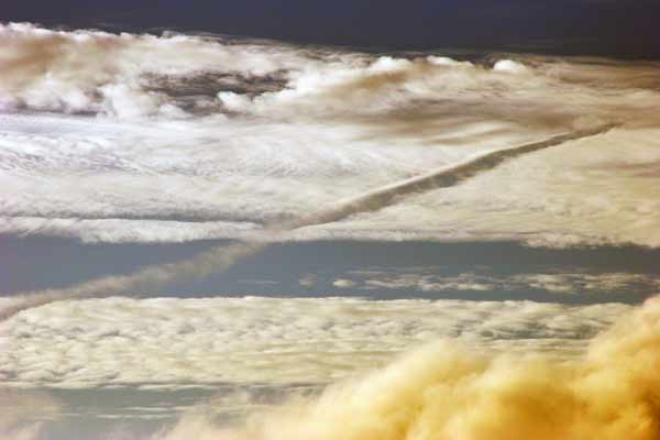
It shows a contrail from the lower left that then turns into a distrail on the upper right, cutting through a layer of clouds.
Distrails form when the contrail makes the cloud actually precipitate. The cloud is just sitting there – small water droplets or ice crystals in the air, but when the contrail comes through it the extra moisture forms larger drops (or ice crystals), which fall, leaving this gap. It’s very straightforward, but it looks a little odd, and puzzled this guy back in 1944:

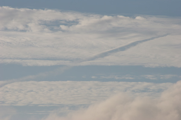
My photo of the distrail above looks quite dramatic, but it’s actually slightly misleading. I’d enhanced the contrast to bring out the details in the cloud, and it gave it a rather dramatic orange cast. The original is a little more relaxed – which illustrates a problem with photos of contrails – they can look a little suspiciously colored, but it could quite possibly be post-processing that made look that way.
Just a note:
When the sun is close to the horizon at dawn or dusk, then its light passes through more of the atmosphere, and the blue component of the light is subject to more scattering.
This will cause lower clouds in the atmosphere to be lit by a yellower light. By post-processing, this has been exaggerated.
Another thing that can happen is that under lower light levels the light reflected back from the ground can backlight the lower clouds with green or red light, depending on the colour of the earth or vegetation.
Yes, just about any “pretty” photo of clouds has been enhanced in some way – usually just increasing the contrast.